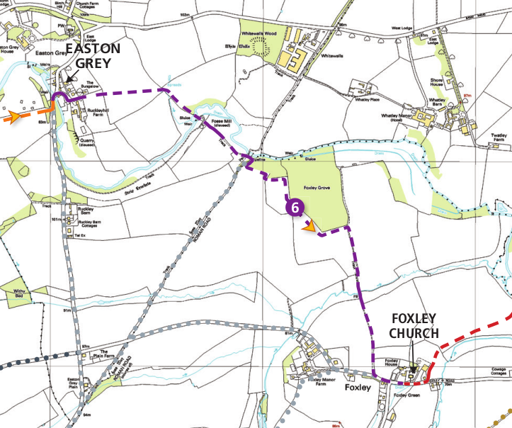
Stage 6
From the listed Tudor period bridge at Easton Grey, this stage follows the valley, crosses the river and the Roman 'Fosse Way', and then crosses fields to end at the C12th church in Foxley. At the Fosse Way the trail passes the site of the Roman settlement known as 'Whitewalls' which gives the trail its name.
About us
The White Walls Way has been developed by Malmesbury Area Pathfinders (MAP), with funding from the Steve Cox Mayoral Fund, Malmesbury Carnival, and Wiltshire Council's Malmesbury Area Board. MAP is a community group dedicated to promoting walking in North-West Wiltshire.
MAP is part of MVCAP, a registered community charity (Reg: 1155592) based in Malmesbury, Wiltshire, UK.
(c) 2021 MVCAP
MAP is part of MVCAP, a registered community charity (Reg: 1155592) based in Malmesbury, Wiltshire, UK.
(c) 2021 MVCAP

|
|

|

|
